Climate proofing the Brabant River Region

Rivierengebied Brabant, NL

Type: Design research
Year: 2024-2025
Location: Provence Noord-Brabant, NL
Size: 100 – 200 ha
Client: Provincie Noord-Brabant
I.c.w.: Gemeente Oss, Waterschap Aa en Maas
Team: Cees van der Veeken, Marit Schavemaker, Simon Verbeeck, Giulia Arentino

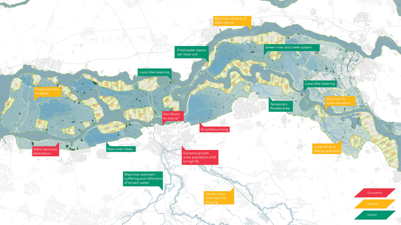
Superdikes vs. Green River – Climate proofing The Brabant River Region

How can the river area of North-Brabant adapt to changing climate conditions, and which strategic decisions must be made in both the short and long term? Commissioned by the Province of North-Brabant, we explored how the landscape can remain safe, resilient, and attractive far beyond 2100. Our approach considers the landscape as an integrated system, where soil and water determine possibilities, rather than a sum of individual measures.

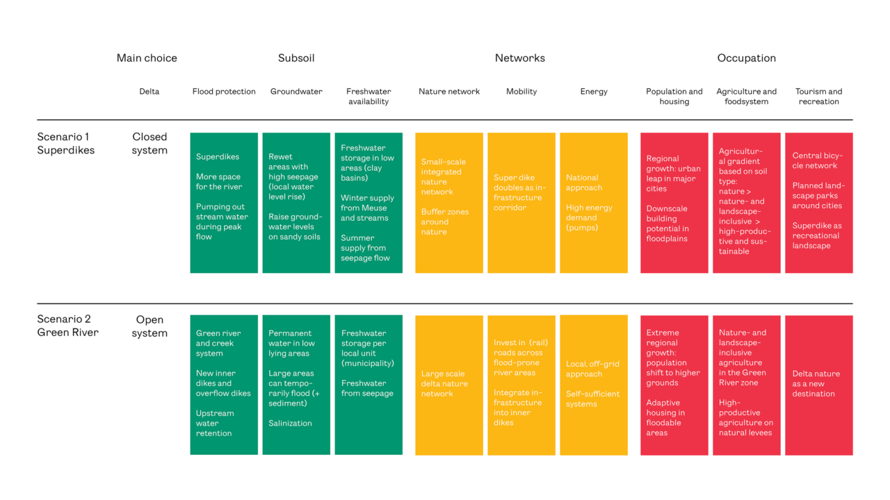
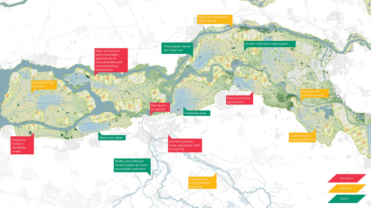
We developed two extreme scenarios for the distant future (>2100), based on the KNMI ’23 climate scenarios. One scenario focuses on drought conditions, while the other emphasizes increased wetness, with both scenarios accounting for extreme peaks in river discharge during both high and low water levels.

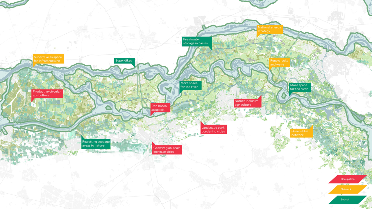
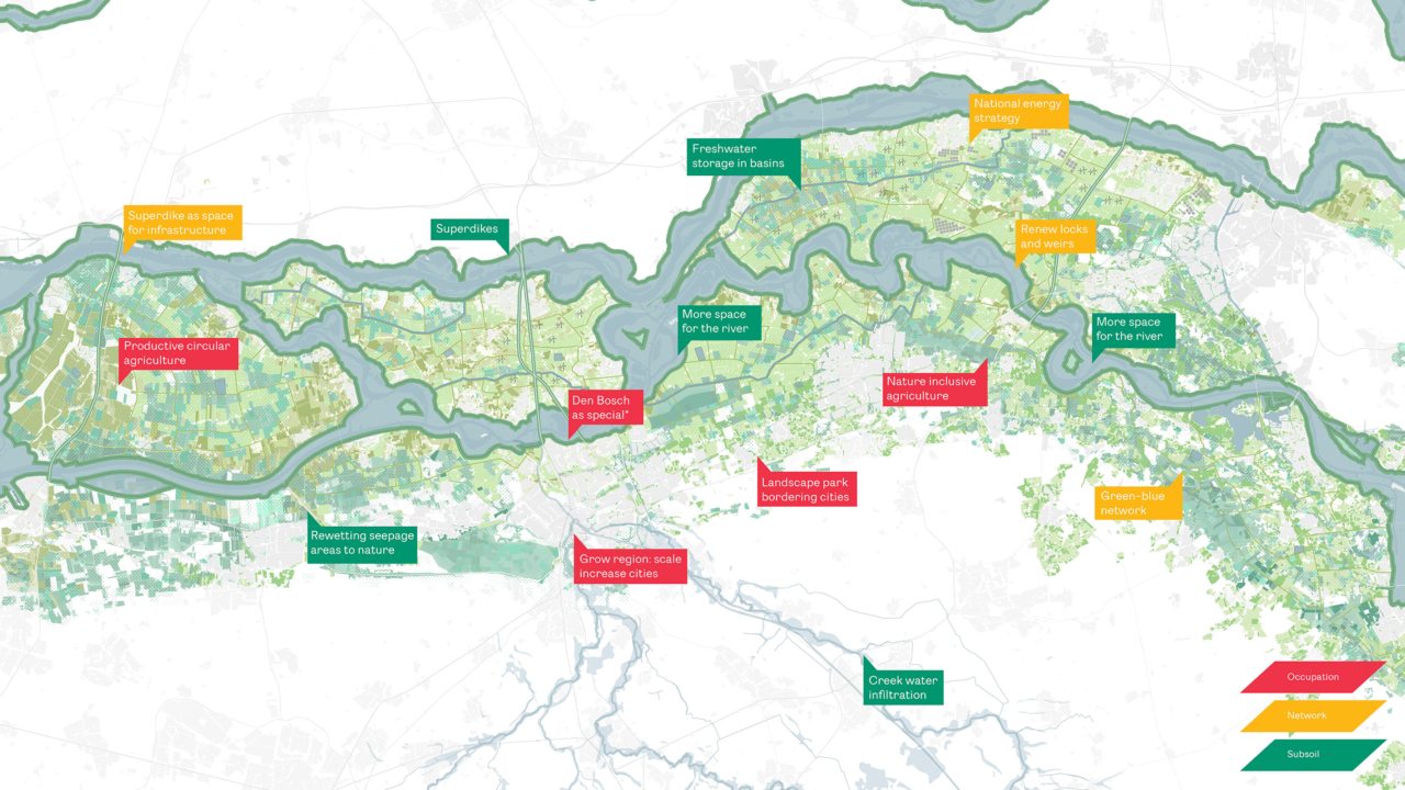
Scenario 1: Superdikes

This scenario envisions a technologically driven, closed system featuring superdikes measuring 90 to 150 meters wide, powerful pumping systems, and strategic river expansions where urban bottlenecks arise. Strong central governance is essential to ensure maximum water safety.

Scenario 2: Green River

This scenario adopts an open delta approach, using a national strategy for an open coastline to transform the river area into a dynamic delta landscape. Ring dikes protect elevated fertile grounds suitable for residential use and intensive agriculture, while lower floodplain areas are periodically allowed to flood, evolving into a robust delta nature network. Decentralized governance promotes locally organized water and energy systems, enhancing self-reliance.

Strategic flexibility: transition pathways

Given significant uncertainties around long-term climate change (>50 years), it’s crucial to make smart, ‘no-regret’ decisions today. Our timeline towards 2150 identifies investments that keep both scenarios viable, encompassing measures for water safety, drinking water, and energy provision. Future land use must align with soil, water, and natural systems, incorporating space for nature-inclusive agriculture in lower areas. Additionally, elevated and secure mobility infrastructure is essential to retain the future choice between open or closed water systems. Current investments must preserve this flexibility.

Design quality

Both scenarios integrate technical interventions with spatial quality enhancements. Superdikes become recreational landscape parks, while the Green River creates a unique delta paradise offering experimental opportunities for amphibious living. Agriculture adapts across a fine-grained gradient, ranging from highly productive circular systems on fertile lands to silvopastoral and extensive nature-inclusive systems in lower areas. This approach enhances biodiversity, improves water retention, and fosters a sustainable regional food system within a safe and appealing landscape.

Read more about ‘Ontwerpend onderzoek Samenwerken aan ruimtelijke opgaven’ (design-based research collaborating on spatial challenges): Provincie Noord-Brabant

Download our full report: Here

Structure of the two scenarios

Scenario 1 Super dikes - summer

Scenario 1 Super dikes - winter

Scenario 2 green river - summer

Scenario 2 green river - winter

Transition path superdikes

Transition path green river

Transition pathways